Basirhat, North 24 Parganas District
West Bengal, India, 743411
Why is Basirhat, North 24 Parganas District known
- Gateway to Sunderbans
- Excellent connectivity to nearby highways
- Shopping malls and market in proximity
- Chandraketugarh, an archaeological site
- Excellent parks in the area
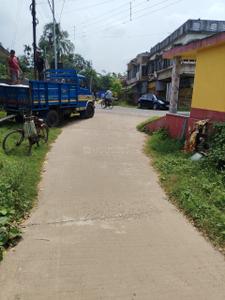
- Good road connectivity
- Nearby market areas
Explore Neighbourhood - Map View
Name | Distance |
|---|---|
Rabindra Mukta Vidyalaya Basirhat | 1000 m |
Bhabla Tantra Sir Rajendra High School(H.S.) | 900 m |
BASIRHAT P. C. MAJUMDER GIRLS' HIGH SCHOOL (H S)) | 900 m |
New Age Public School | 4.8 km |
Name | Distance |
|---|---|
Basirhat | 700 m |
Bhyabla Halt | 700 m |
Matania Anantapur | 3.1 km |
Madhyampur | 5 km |
Champapukur | 5.6 km |
Name | Distance |
|---|---|
Ghare Baire | 300 m |
Only Momo | 300 m |
Food Hub | 1.2 km |
Sri Krishna Biryani | 700 m |
Name | Distance |
|---|---|
Kolkata Mart Shopping Mall | 1.2 km |
Visal Shopping Mall | 1.1 km |
Insights about Basirhat, North 24 Parganas District
New developments
- Basirhat Municipality has invited tenders for construcion of concrete roads
- Tenders for improvement of road by stone cosolidation are invited by the municipality
- Central Government will start the 318km four-laning of the road connecting Jangipur and Basirhat by the end of 2022
- Basirhat will soon be a new district as per the declaration of the West Bengal State Government
- The West Bengal State Government will accelerate developmental works in Basirhat
What is good in Basirhat, North 24 Parganas District
- Nearest railway station and airport are Basirhat and Netaji Subhash Chandra Bose International Airport, Dumdum
- State Government has planned Barasat-Basirhat Road Upgradation Project
- The 318km four-laning of the road connecting Jangipur and Basirhat will ease the traffic situation in the daytime
- The government has decided to boost safety around Kachua Loknath Temple where people were injured in a stampede
- The High Court has asked the West Bengal government to install street lights in Basirhat area to ensure women’s safety
- A special woman patrolling team called 'The Winners' has been formed comprising of lady police personnel in Barasat area
- There are various parks in Basirhat like Alok Jharna Park,Surja Kanta Park, Rabindra Saikat Park etc
- More than 10,000 sanitary pads will be given to women in Basirhat
- The Air Quality Index or AQI of Barasat is 73, which is considered moderate
- Basirhat is close to Kolkata, located on the banks of Ichamati, having cultural and historical significance and its proximity to Sunderbans
- There are more than 5 Government organiations many other private offices including NGOs in Barasat
- National Highway 312, a secondary route of National Highway 12, connects many areas including Ghojadanga, Basirhat
What can be better in Basirhat, North 24 Parganas District
- Due to inadequate passenger, unavailability of workers and pay cuts, public bus services has been reduced to bare minimum
- The inter-city roads are unpaved and in bad shape in Basirhat
- People of Basirhat complaints that road are full of potholes
- People still do not feel safe in Basirhat, especially at night, due to the political disputes
- People in Basirhat complain that many of the newly constructed 700 street lights are not working
- Due to lack of strict police patrolling, activities of criminal gangs near Bangladesh border have been increased
- Curently, there is no underground sewerage system in Basirhat area
- The pollution caused by the Bantala leather complex had been endagering several kinds of fish from the river Bidyadhari
- There are around 200,000 people whose livelihoods are dependent on Ichhamati, but the river is dying a slow death
- Repairing work is very slow going on the National Highway 312
- Rental rates in Basirhat are high due to the proximity to markets and malls
Ratings and reviews
Resident reviews for
Basirhat, North 24 Parganas District
Ratings based on features
Good things here
Things that need improvement
All resident reviews (7 reviews)View All

Owner | 3 years ago
The town is famous for its thriving local markets and bazaars. Visitors can explore the vibrant street markets and shops, offering a wide range of goods, including textiles, handicrafts, and fresh produce.
Owner | 3 years ago
The Basirhat area celebrates various festivals with great enthusiasm, including Durga Puja, Eid, and Christmas. These festivals bring the community together and showcase the cultural diversity and traditions of Basirhat. As a residential area, the locality is awesome because of the connectivity and convenience.
Owner | 3 years ago
Basirhat boasts excellent connectivity, with well-developed road networks and access to public transportation. It is centrally located, providing convenient access to other prominent areas of Kolkata, including shopping centers, restaurants, and entertainment venues.
Owner | 3 years ago
Basirhat is surrounded by picturesque natural beauty, with the Sundarbans mangrove forest and the Ichamati River in close proximity. Nature enthusiasts can enjoy boat rides, birdwatching, and exploring the unique ecosystem of the Sundarbans.
Tenant | 3 years ago
Basirhat is a historic town with a rich cultural heritage. It is known for its religious diversity and is home to several temples, mosques, and churches, making it a symbol of communal harmony.