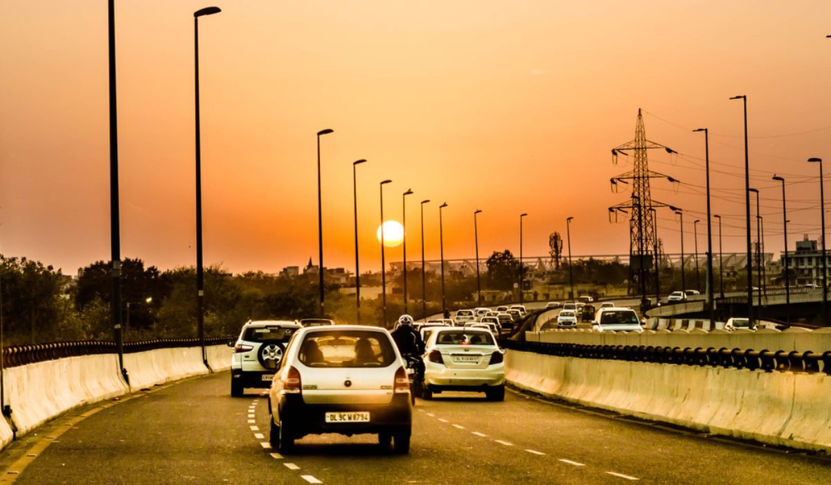
The Barapullah Flyover provides vital connectivity in Delhi. Spanning the Yamuna River, the Barapullah Bridge connects south Delhi with the eastern areas of the city. It is located near landmarks, such as Humayun’s Tomb and Nizamuddin railway station.
In this guide, we provide useful information about the Barapullah Flyover in Delhi.
Barapullah Flyover history
The modern Barapullah Flyover was developed in 2001 to provide road connectivity between South Delhi and the eastern parts of Delhi. The name, Barapullah, was derived from the 16th-century water canal that flowed in the same location and was built during Sher Shah Suri’s reign.
The Mughals used the Barapullah Bridge built by Mihr Banu Agha to cross the Yamuna River and reach Nizamuddin Dargah and Humayun’s Tomb while returning from Agra. The stone bridge runs parallel to the current bridge on the way towards Nizamuddin railway station. The structure is 200 metres long with 12 piers and 11 arches.
In 2016, the Delhi Government decided to rename the Barapullah Flyover to Baba Banda Singh Bahadur Setu.
Barapullah Flyover connectivity
The Barapullah Flyover, under Phase 1, connected Sarai Kale Khan on the eastern bank of the Yamuna River to INA Colony and Jawaharlal Nehru Stadium complex on the western side. It crosses several commercial areas of South Delhi, including Nizamuddin, Lajpat Nagar and Greater Kailash. The Barapullah Flyover connects the Delhi-Noida Direct Flyway (DND Flyway) through a slip road, saving commuting time.
Extension of Barapullah elevated corridor
The extension of the Barapullah elevated corridor is a long pending infrastructure project. The 3.5-km stretch will connect Mayur Vihar Phase I to Sarai Kale Khan and merge with the existing Barapullah Phase I, enabling a signal-free commute between east and south Delhi.
The elevated corridor will comprise four-lane, dual carriageways with a width of 17 metre on both sides. The project started in 2015 and is being developed at an estimated cost of Rs 1,068 crore. The Public Works Department (PWD) is constructing the project.
Barapullah elevated corridor: Features
The Barapullah elevated corridor will be equipped with essential features, such as footpaths, cycle tracks, streetlights, NMV lanes and space for kiosks.
FAQs
Why is Barapullah called so?
Barapullah flyover was named after a stone bridge built in the 16th century.
How long will be the Barapullah elevated corridor?
The Barapullah elevated corridor would be 3.2 km long.
| Got any questions or point of view on our article? We would love to hear from you. Write to our Editor-in-Chief Jhumur Ghosh at [email protected] |
Harini is a content management professional with over 12 years of experience. She has contributed articles for various domains, including real estate, finance, health and travel insurance and e-governance. She has in-depth experience in writing well-researched articles on property trends, infrastructure, taxation, real estate projects and related topics. A Bachelor of Science with Honours in Physics, Harini prefers reading motivational books and keeping abreast of the latest developments in the real estate sector.


